Author Archives: Sally


About Sally

A Studio Artist and painter trained at Stanford university, Sally has since then graduated from a long career as an Attorney with the Public Defender, and returned to painting. Living in Mexico with her son for a year, they adopted a feral dog, Lety. Sally's son left for college and their dog adopted her new best friend, Steven.

SERIOUSLY NORTHERN ARTS & GAMES: INUVIK, NORTHWEST TERRITORY

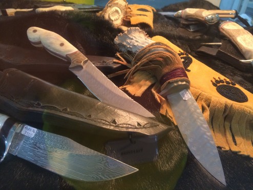
As volunteers and workshop participants at the ten day, “26th Annual Great Northern Arts Festival” in Inuvik (in-NEW-vik), we enjoyed making friends, sharing meals and learning new art techniques from the generous, mostly Inuit artists from the Western and Eastern Arctic. Due to their traditions working with ALL parts of the animals they hunt, there were art pieces made from sealskin, tusks, fur and hides, antlers, and muskox undercoat, the warmest fiber on earth by weight, and workshops to make knives, soapstone sculpture, whale bone jewelry and warm Arctic clothing.

IMG_1062

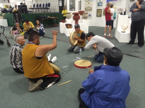
Spontaneous games and musical events erupted in the middle of the art gallery, this one a guessing game like rock-paper-scissors, except with over 50 gestures, and at high speed to keep up with the beat of the drummers!

IMG_1070

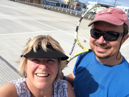
With only 2800 residents and the most northern stoplight in the world, the town can boast a wealth of modern amenities, beyond most Arctic towns of this size, due to the efforts of the Inuvialuit (in-NEW-vee-ah-LOO-it) Regional Corporation. The Inuvialuit Settlement Land treaties and agreements with the Governement were resolved in the Inuit’s favor many years ago. Given the wealth generated by gas/oil/mineral rights in their settlement lands, they have tremendous political clout. They own the tallest building in town, and have persuaded the Federal Government to build a great aquatic and fitness center, with squash courts, curling and ice hockey arenas, a large community greenhouse (you can imagine how large vegetables can grow with 24 hours of sun every day!), new tennis courts we enjoyed daily, and a baseball field. With warmer weather than San Francisco, and bright sun at midnight, it feels like a summer afternoon in California, and baseball goes on all night during tournaments.

IMG_1061

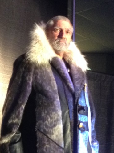
The annual fashion show is one of the hits of the week, as models strut the runway in floor length seal coats and other Arctic wearable art. The other is the throat singers from Nunavuut who improvise very percussive singing making breathy percussion and singing on both the in and out breaths. Tanya Tagaq is a famous throat singer who performs with the Kronos Quartet. Check it out on your itunes.

Inuvik Model

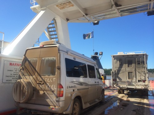
In comparison, the Gwiitch’n First Nation people who live on the Peel River in the Yukon Territory, are still negotiating use and management treaties of their settlement lands, and last week brought suit against the Territorial and Canadian Governments in the Trial Courts in Whitehorse YT on far weaker terms than has already been established by the well-organized Inuvialuits. “Protect The Peel” is the most common bumper sticker in town as the Inuvialuit are hoping that the Peel River watershed is protected; it flows into the Mackenzie River that Inuvik relies on for food, water, and cultural traditions as it flows to the Arctic.

IMG_0876

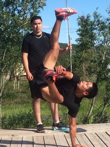
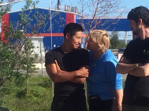
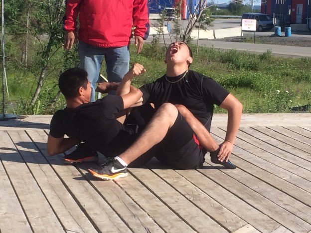
Appropriately, the theme of the week long Circumpolar Northern Games is, “Ukiuqtaqtumi Hivuniptingun…One Arctic, One Future”. Above, James and DangDang exhibit an agility game; starting from a seated position and holding one foot, competitors must launch upwards to kick a ball…that keeps being raised with each successful kick. In the feature photo, they exhibit a full body arm wresting contest. The Northern Games have 800 participants from as far as Greenland and Russia. The Sami people of Scandinavia and the Yamia people of Russia are traditional Arctic hunters and share the same games designed to keep hunters’ skills honed. The categories are endurance, strength, tolerance of pain, agility, and…social games often based on animal mimicry (below, Sally screeches like a monkey, sniffs his face, and picking pretend picks (and eats) nits off of James, with a goal of getting him to smile…it worked).

IMG_0895

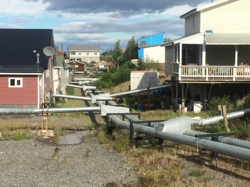
Living in Inuvik, sitting on top of permafrost thousands of years old, makes construction in the town unusual to us; every building must be built on piers on top of the ground, even the two large hotels built in the last two years. The delivery of water and removal of sewage must also be done above ground…and well insulated for -40 F. winter temperatures. The system pictured is a large central insulated Utilidoor running among a cluster of buildings, with Utilidettes running to each residence. Every building in town relies on this system. A year’s worth of diesel for home heating is brought in by two barges once a year before freeze up occurs on the Mackenzie River.

IMG_1059

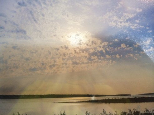
Finally, besides our friendships with Inuvit locals and visiting Arctic artists, we introduce you to the best landscape photographer at the Festival. Gawain Jones is starting a 12 year migration through the Arctic, living within Inuit communities a year at a time. His photo looks like the view of the Mackenzie Delta from our campground (with my reflection in it!); it does not do him justice, so please check him out at gawain.jones@gmail.com.

IMG_1080


WEAPONS OF MASS DETERENCE: BLASTERS, BLISTERS & ELECTROCUTION

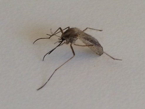
July in the Arctic….each day brings more warmth, more humidity as the bogs heat up, and more bugs. They are also the biggest mosquitoes and horseflies we have ever seen….actual size shown below…Ha!

IMG_0605

Our least favorite weapon is a deterrent: DEET, which works but is sticky and smelly. We have read independent research indicating that a 20% lemon and eucalyptus spray, made by OFF, works as well as 20% Deet. No such thing available in the Arctic of course. So, another great tool of deterrence is a bug jacket that includes a head and hat cover. Unfortunately, it also needs a pesticide as they can sting through it, but it at least keeps the slow and stupid horseflies from continually smashing into your face.

IMG_0723

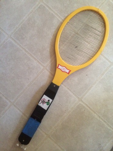
Meet our favorite find: the bug racket. It is very useful in our travel rig as 6-8 skeeters always seem to fly in with any egress, no matter how speedy we are. It looks like a squash racket but the strings are electrified with AA batteries. It is a very effective weapon of mass mosquito destruction, with a satisfying snap, spark, and smoke. It also has a fried meat smell after the kill….very satisfying! Kill! Kill!…not very Buddhist of us. Sometimes deterrence is not enough….note the size of the victim above.

IMG_3428

We have had no problem with bears although we are always armed with a canister of mace that shoots 20 feet. That is still way too close for us as hikers so we also carry “Bear Blasters”. These must be loaded with a bullet like cartridge, pointed skyward, cocked and fired, shooting a blank, that explodes with noise at its apex. Some say it is completely effective. Some say the bears now associate it with hunters shooting caribou….and come running to grab the wounded game. We hope never to test it, but must carry it, even on the local 4 hole golf course exhibiting a warning reading, “Grizzlies on the golf course”, this week in Inuvik, NT. It is the Western Arctic, after all, and a grizzly can only act like a grizzly…

BREAKING UP IS HARD TO DO: “TUK”, NT CANADA

IMG_0970

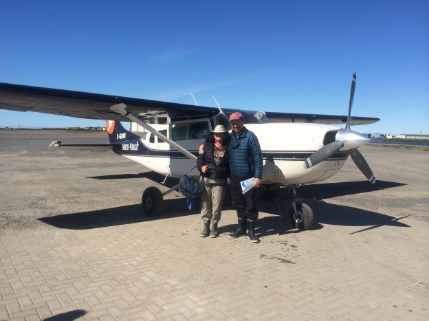
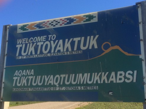
You must cross two rivers, the Peel and the Arctic Red by ferry, and take a boat or flight from Inuvik, out the Mackenzie Delta to reach the far northern town of Tuktoyaktuk on the Arctic Ocean in the Northwest Territories. The land is predominantly settlement lands that have been the homes and hunting grounds of the Gwiich’n and Inuvialuit First Nation people for thousands of years. These two rivers (crossed by ferry in summer) freeze up and become the only passable road in winter. No passage to the far north is possible, except by air, during “Break Up” (during late spring as the ice on the river melts too much to carry vehicle weight and there is too much ice to allow the ferries on the river), and during “Freeze Up” (before the ice is thick enough to support vehicles.

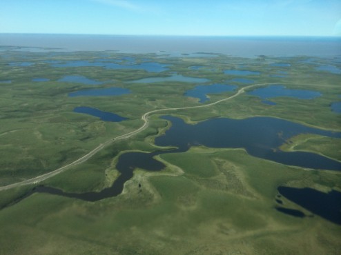
IMG_1045 We took a boat trip from Inuvik to Tuk as there is no road in summer…until completion of a highly controversial, “year round road” in 2016 (see photo above over the tundra at the Arctic Ocean, from our air flight out of Tuk). Other than serving gas/oil interests who want a deep port at Tuk for oil exportation to Asia, and the Canadian Government who wants a road that goes all the way to SOME Northern Canadian border, only 300 people live in Tuk, 8 feet above tideline, to enjoy it. Many predict it will be the longest pier in the world, as Tuk is slated to be underwater within 30 years from the effects of global warming. While Canada and the NT government are laying fiber optic cable between Inuvik and Yellowknife (the NT capital where 90% of Territory residents live), seems a logical time to build a road that would be well used, no one seems to be discussing a road from the capital to the North. The only access now is by air, the Mckenzie River, or by roads so convoluted that little is shipped and nobody travels by road from the capital. Hmmm….politics.

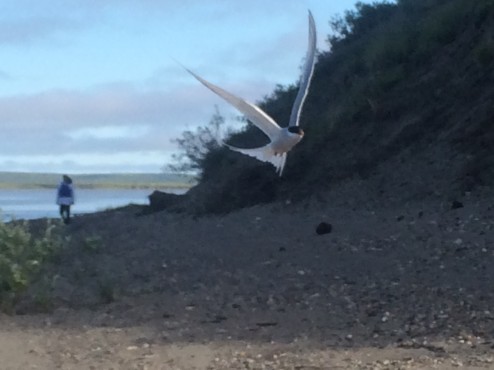
IMG_0922 On the way to Tuk by boat, we not only enjoyed many of the byways of the second largest delta in Canada, at a pee stop I finally got to see Arctic Tern up close, as I stumbled into a nesting area and got dive bombed until I left the area. They are very aggressive and agile birds and we enjoyed watching them hover and dive as they hunted.

IMG_0946

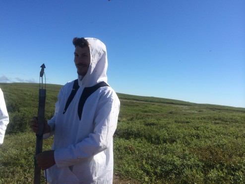
At our guide’s Aunt Clara’s whaling camp in the bush, we arrived after her family had caught one of the three beluga whales they hunt each year. The harpoon seems too primitive to snare a 13 foot long beluga whale but it is effective as we saw another small boat bringing one into another whale camp nearby.

IMG_0964

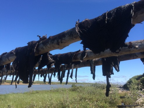
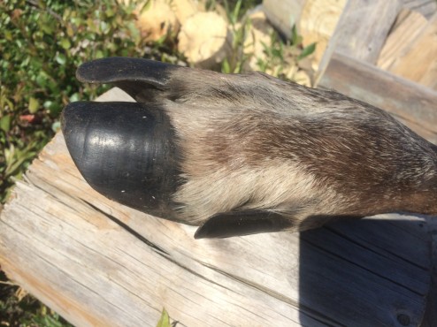
We ate Muktuk (blubber and skin, eaten raw or boiled), dried whale meat (above), herring, and caribou (from one who wandered into camp the week before). The entire extended family lives off these meats during the winter.

IMG_0941

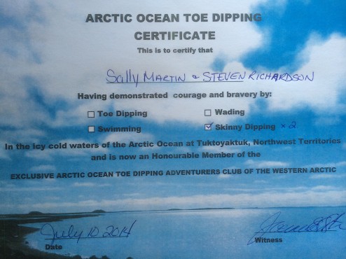
We couldn’t resist naked immersion in the Arctic Ocean; there is no need to torture you with a naked picture as we got a certificate for proof!

IMG_0976

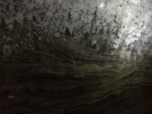
We visited the community Ice House by climbing 30 feet down a frozen slippery ladder into the permafrost (mud frozen solid for more than two years continuously) into a community meat locker still used for storing large kills year round. So beautiful, the layered permafrost covered with oddly square ice crystals.

IMG_1007

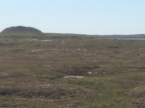
We also hiked up a “Pingo” which is a tundra covered tall mound. It is filled with permafrost and created when a lake empties out suddenly with a breach, allowing the outside to freeze solid like a donut around unfrozen water which can only expand upward as it freezes. There are more than 1300 of these in the Western Arctic and we could see new ones forming as we flew over the Arctic tundra.

IMG_0930

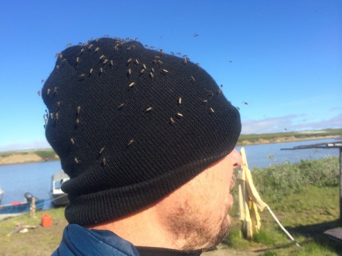
We really appreciated the warmth and hospitality of this Inuit family. They are so tough, and so family oriented, creative, and quick to laugh. It would require all those things to survive a month trying to work in the bush with these voracious mosquitoes. Here’s a scary picture of Steven’s toque covered with about 150 mosquitoes.

IMG_0923


THE DEMPSTER HIGHWAY: “MILES AND MILES, OF MILES AND MILES…”

….OF DIRT AND GRAVEL ROADWAY. Specifically, that would be 467 miles North, and 467 miles South, crossing 2 mountain ranges, 2 river ferry crossings, the Continental Divide and the Arctic Circle, and requiring 25-35 mph maximum driving speeds at all times. We feel lucky to have only 2 rock chips in our wind screen; almost all cars in Inuvik at the end of the road have severely cracked windshields, and had to use their spare tires on route.

IMG_0721

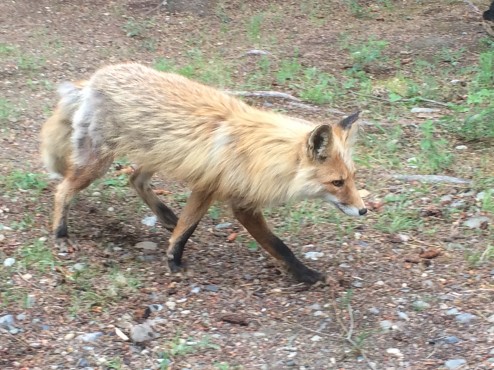
Something about the sun still being above the horizon at 2 AM makes it easy to stop frequently for bird identification, short hikes (the bugs are voracious), naps….and more driving. Our first day yielded a molting fox, a nesting Say’s Phoebe just 3 feet over our heads…and a Tea Party to celebrate Canada Day at the Tombstone Provincial Park. The Staff foraged for last year’s sweet wild cranberries (sweet from freezing all winter and ripening further in their second summer on the bush) for cake, and a tea made from 3 plants: Labrador Tea, Spruce tips, and Coltsfoot.  Tasted like eating/drinking Xmas trees!

IMG_0594

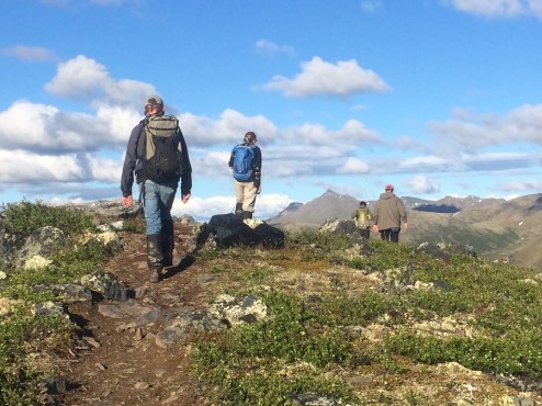
On a ranger led hike up the Goldenside Trail in the Ogilvie Mountains, to a harem of marmots (not just a group identifier like a ‘murder of crows’, marmots live in female harems), we spotted a white crowned sparrow in the sub-arctic tundra, at the upper boundary of the tree zone.

IMG_0677

Speaking of birds, here’s our list so far: American Raven (everywhere, horrible beggars), Say’s Phoebe, Yellow Warbler, Small Eared Owl (sited at the Arctic Circle, hunting in daylight since there is no darkness), Willow Ptarmigan, Bald Eagles including an immature, Gyrfalcon, and our favorite sighting, a Red Crossbill, noteworthy for its top and bottom beak criss-crossed. We are still hoping for an arctic tern sighting, the longest migrator of them all, and a bird that hovers like a hummingbird before it dives for food, eg. we might be able to get a picture! As beginning birders we mostly are paging through our book looking for “grayish, brownish little birds” who all look alike to us. Often, females and these little songbirds are described as, “Confusing”. We wonder if our birding pal Judith secretly intended to drive us crazy with the gorgeous Northern bird identification book. We like it better when she just points out and identifies birds for us on walks. No confusion.

IMG_0675

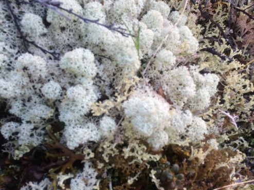
If we were smart we would instead be working on our lichen identification skills as there are so many beautiful lichen (1500) and the variety is amazing in the Arctic; this lovely Caribou Lichen stays still and smiles for our pictures. The First Nation people here take it partially digested from a caribou stomach after a fresh kill, mix it with fish eggs, and eat it as a dessert called, “Stomach Ice Cream”. Here’s a test: Would you try that frothy white concoction?

IMG_0665

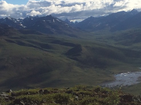
Our sightings of Tundra Moose (the largest moose on the planet), snowshoe hare, bison and calves, and black bear and cubs were lovely but, like birds, too far away or too fast for good pictures…so we like landscapes…that stay in place.

IMG_0683


WORLD’S LARGEST WINDVANE & LONGEST CANOE RACE: THE YUKON

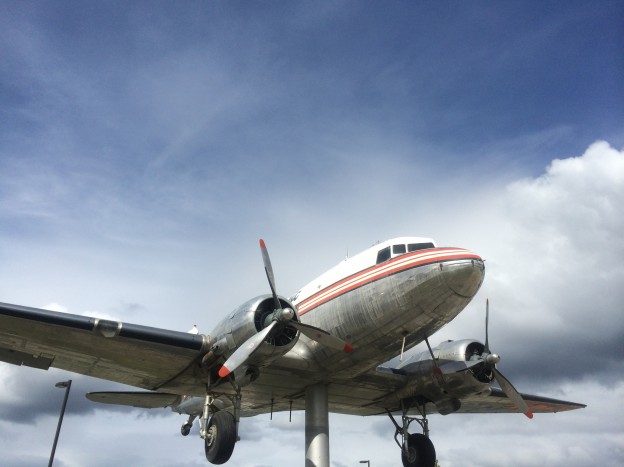
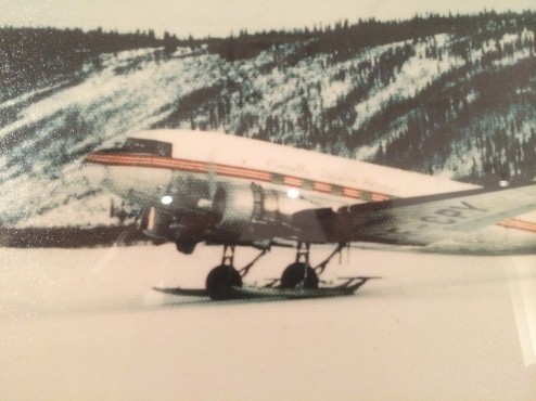
This DC-3, a workhorse in the Yukon for years, went nose down twice, skidding the icy runway, and landing in too deep snow using tires instead of the attachable skis. It also sunk once when it landed on melting lake ice, and broke through. Now it swings in the wind outside the Yukon Transportation Museum.
IMG_0550

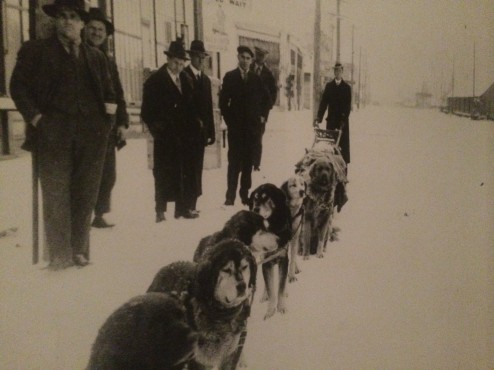
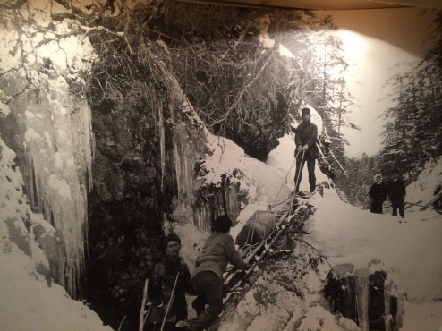
Inside, the museum documents the myriad transportation options relied on in this harsh winter environment. My favorites are the businessmen waiting in Whitehorse for their “taxi”, a dog team….
IMG_0561

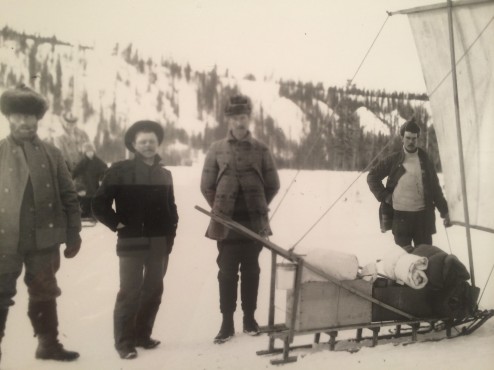
The arctic wind often blows upriver allowing this enterprising fellow to dispense with the dog team and hoist a sail on his dogsled to carry him over the ice.

IMG_0553

Walk through history, following the wonderful poetry of Robert Service describing the lust for gold in 1987, and the hardship and risks faced in the extreme weather, herein the first and last stanzas of his most famous poem, The Cremation of Sam McGee.

“There are strange things done in the midnight sun by the men who moil for gold; The Northern lights have seen queer sights, But the queerest they ever did see Was the night on the marge of Lake Labarge (sic) I cremated Sam McGee.” “And there sat Sam, looking cool and calm in the heart of the furnace roar, and he wore a smile you could see a mile, and he said, “Please close that door. It’s fine in here, but I greatly fear that you’ll let in the cold and storm – Since I left Plumtree, down in Tennessee, it’s the first time I’ve been warm.”

Klondike Fever

Klondike Fever

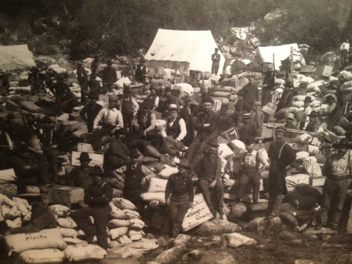
One million laid plans to go to the Klondike. One hundred thousand actually set off and about thirty thousand made it. One tone of goods and a hard grind up the Chilkoot Trail got you into the Klondike. Gold seekers were required to pack and carry their goods over the Chilcoot Pass. The list of supplies required for each person weighed a ton, and included 400 lbs. of flour, 100 lbs. of beans, and 100 pounds of sugar, to name just a few. This took 40 trips of 33 miles each, equalling 2600 miles up the icy stairs in sub-zero temperatures to the summit. This took most gold seekers at least three months before they got to the Yukon River.

IMG_0554

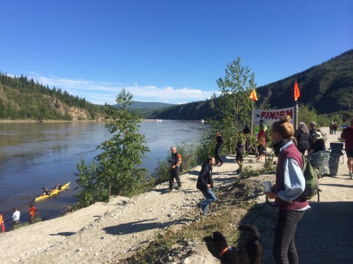
The novices were called “Cheechakoes”, and after surviving one winter, became “Sourdoughs”. Initially, lashed logs, canoes, and every manor of boat that could survive the Class III rapids tried to float the 440 miles on the Yukon River between Whitehorse and Dawson City. We lucked out and arrived in Dawson City in time for “Yukon River Quest”, a four day race in canoes and kayaks covering the same distance. It has remained for 16 years the longest distance canoe and kayak race in the world, this year enrolling 66 teams from 13 countries. This year’s race started out in horrible conditions with high winds and 6 foot waves in Lake Laberge, the hardest part of the race even in good weather. Even with two planned safety stops, providing 10 hours of rest, 15 teams withdrew, and the rest paddled two fully lit nights and 3 full days to arrive in Dawson City.

IMG_0620

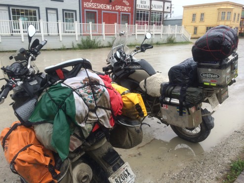
Another grueling trip deserves mention as well. Two sweet guys from the Distrito Federale (Mexico City) rode their bikes 4,560 miles arriving here in a rain and wind storm yesterday. I know how much they (and the kayakers) appreciated the day of very intense sun we finally got today. Viva Mexico! Viva Hidalgo!

IMG_0598


HAPPY ABORIGINAL DAY AND SOLSTICE: WHITEHORSE, YUKON, CANADA

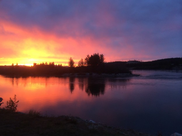
The featured image is a shot of sunset over the Yukon River… photographed at 10 minutes before Midnight last night! We sleep for a few hours in twilight before the sun rises again around 4 AM, about 20 degrees off the location it set 4 hours earlier. Weird. It feels a lot like jet lag the next day.

IMG_0332

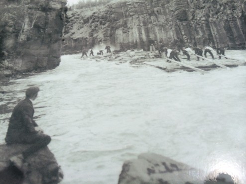
Due to the long dark winters, this small town erupts with activities celebrating the longest day of the year. This weekend we are parked near the 30 bands playing the “Sunstroke Festival”, the Farmer’s Market, and the Millennial Trail to narrow Miles Canyon where the Whitehorse Rapids claimed many river travelers lives during the Gold Rush, and created the name for the town. Now flooded out by a downstream dam, the water still roils with eddies, whirlpools and strong currents. There is a very personal memorial riverside, celebrating the life of a 20 year old boy who drowned here one year ago rescuing his dog. My first illogical thought was, “I would kill MY 20 year old son for doing something so stupid”, before I felt that boy’s mother’s deep grief and loss.

IMG_0461

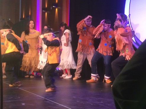
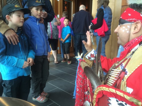
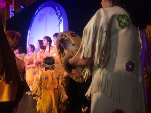
The other wonderful event this Solstice weekend was a gathering of First Nation people at the Kwanlin Dun (“People of the Water running through the Narrows”) Cultural Center, celebrating Aboriginal Day. As it was mostly First Nation people attending, it felt like sitting in on someone else’s big happy family reunion. We enjoyed the drummers who performed at the 2010 Olympic Games in Vancouver, several dance troupes, and elders in traditional dress teaching First Nation culture by way of storytelling.

IMG_0360

The Truth and Reconciliation Project had the saddest story to tell; the Canadian government forced assimilation of First Nation people by removing their children and raising them in large residential institutions. The last institution closed down in Saskatchewan in 1996, so a generation of aboriginal people have no knowledge of their history and culture, no experience of family and parenting, and thus no First Nation pride… just the bigotry against “Drunken Indians” that runs rampant in parts of Canada.  In fact, I heard a security guard at the Sunstroke concert tell a First Nation Family on their bikes standing at the fence enjoying the music, “Your indian party is over there”.  For more information on the Canadian Residential Home Program, read personal accounts of the experience in the Truth and Reconciliation Commission book, “They Came For The Children”.

IMG_0422

Earlier, on my way to the nearby “indian party”, I came upon a First Nation man, clean and well-dressed, passed out in the parking lot with a bleeding nose, while adults and teens walked and drove by him offering no assistance. He did not smell of alcohol, and his pin point pupils, non-reactive to light suggested opiate overdose. Perhaps he was neurologically impaired due to a blood sugar issue or some other medical issue? Once I ascertained he wasn’t dead (good pulse and respiration) and got him turned on his side so he wouldn’t asphyxiate on vomit, I found a security guard to call the paramedics, who arrived quickly and moved him out on a gurney. The security guard said he was not surprised at the lack of response from the disinterested passersby, “It is a sad and shameful response, but it’s so common in Whitehorse to find drunken First Nation men injured from falls, that most people here just don’t care, and don’t respond anymore.”  It’s almost impossible to re-educate bigotry when stereotyping is enforced by repetition in daily life. We enjoyed that many young First Nation people were involved in the arts and music presentations today, especially great hip-hop/rap artists that were so percussive, they were really swinging!

IMG_0532

WET, LIQUID FUEL: W.A.C. BENNET DAM

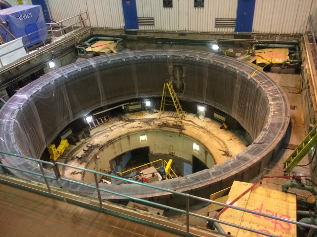
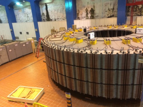
We donned our hard hats and safety vests and toured the inner working of the dam creating the 3rd largest artificial lake in North America, Williston Lake. It is so large it took 55 million cubic feet of dirt to build the dam and five years to fill the lake with inflow from two rivers after the dam was installed. We lucked out and toured the facility while one side of the powerhouse was shut down and wide open for installation of new rotors (feature image). The powerhouse is buried sixty stories under ground and from bottom to top is almost as tall as the Eiffel Tower. The transmission station is on the surface as we stand on the top of the 610 foot tall dam, all the more amazing as it must be both 1/2 mile wide at the bottom to support both the slender road 1/2 mile road along the top of the dam,  and the weight of the water.

IMG_0316


The dam’s 10 turbines generate more than 13 billion kWh annually. To put this in perspective, our  1100 sq. ft. roof in Albany, CA is covered in solar panels and generates 1800 kWh annually; we generate enough electricity to meet our needs and still sell back electricity to the utility company. However, unlike Canadians, we don’t need electricity to survive freezing winter temperatures and darkness between 2 PM and 9 AM.

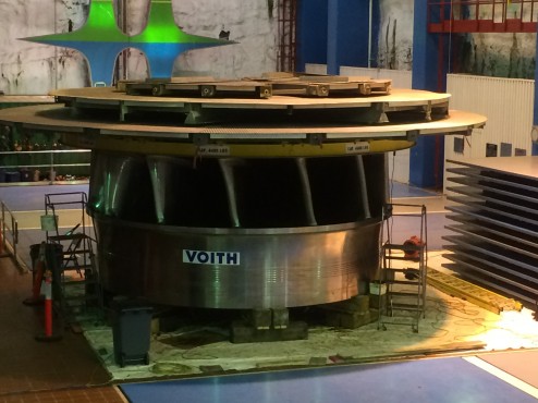
IMG_0307If all ten turbines ran at the same time 1.4 million litres of water surge into the turbine runners (water wheels like the one above) using 93% of the dedicated water to turn huge shafts that then spin the electricity producing rotors in the photo below.

IMG_0297The water is released to flow down the Peace River to another hydroelectric station with six turbines, and then onward to the Arctic Ocean. As this dam produces 40% of British Columbia’s energy needs, and is renewable, the cost to build and maintain the dam seems negligible compared to the benefit…unless you value the plant and animal biodiversity destroyed by flooding 375,000 acres of prime forest. Also the displacement of the Tsay Keh Dene First Nations residents, the Ingenika, caused, “Isolation, alienation, dependence and illness”, clearly severe environmental impact. At least Canada paid the Aboriginals a $15 million lump sum and a $1.6 million inflation adjusted annual payment. Although that creates dependence and dislocation, I wish we, our US federal government, had at least tried to contribute fairly to our displaced tribes, instead we gave them the genocide called the Trail of Tears, the massacre at Wounded Knee,  and life on “The Rez”, eg. chronic poverty, alcoholism, disease, and such crummy quality land that casinos are the only way to make a living on most Native American Indian reservations.  Shame on us.

QUEEN OF ALL SPAS: LIARD HOT SPRINGS

We are big fans of a hot soak; we seek hot springs out everywhere we go. Soaks under 104 degrees F. qualify as “warm springs”… and just don’t cut it. Our favorite hot spring, Pah Tempe in Hurricane, Utah was taken by legal action last year due to taint of the flavor of city water.  Fortunately, we have a new favorite in Liard Hot Springs, British Columbia, Canada.

IMG_0324

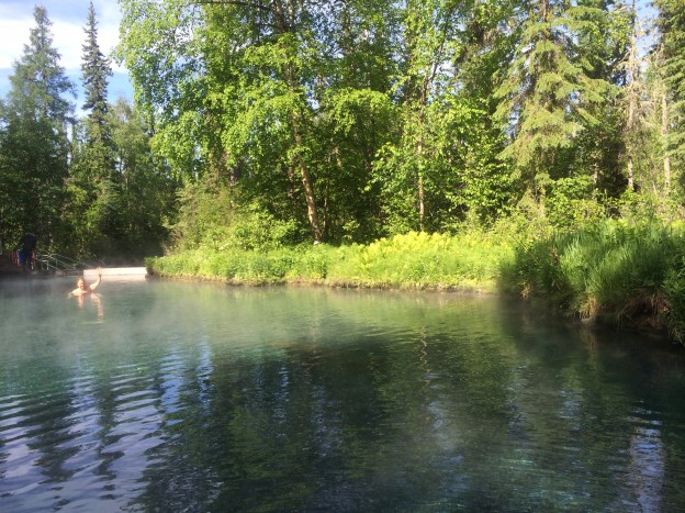
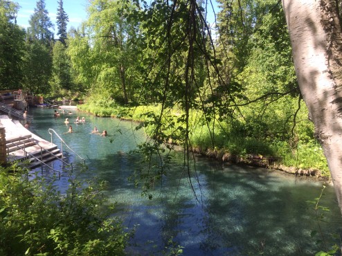
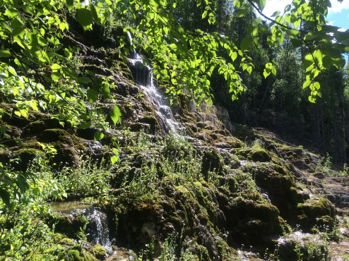
Like it hot? Swim up towards the 136 degree F. source. Too hot? Swim downstream through cooling temperatures, all the way to chilly snow melt run off. It has very clean and clear water due to the volume production so you want to just keep moving up and down the current, finding your bliss point. Too wrinkly? Get out and hike up to the “Hanging Gardens” with waterfalls and orchids.

IMG_0327

Too crowded? It is open 24 hours/day so you can go in the early morning and only run into the staff sweeping the rocks on the bottom with brooms to keep the pools clear of algae, and the water clear (feature image).

CHAINSAW MASSACRE: CHETWYND, BC CANADA

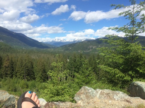
We jammed north, breaking up long driving days with brief visits to friends and family in Portland OR and Vancouver BC. We camped for a few days at a former airstrip on the side of a mountain (below) near Whistler Village with a glacier view, allowing us to dine with Steven’s lovely neice Samantha, who resides there now, after a childhood in Greece and early adult years in Australia.

IMG_0173

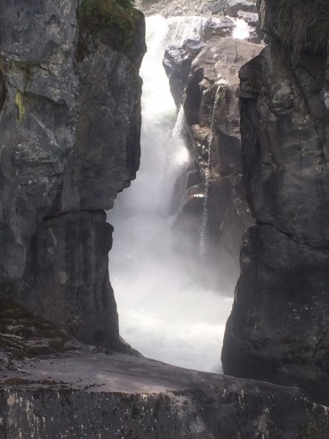
Whistler is very “well coiffed”, and feels a bit like a tasteful retail version of Disneyland in the mountains…until you see the throngs of muddy, trashed mountain bikers careening down the slopes. We more sedately enjoyed 3 hike-in waterfalls on the Sea to Sky Highway (Nairns Falls below) before reaching the AlCan Highway 97 again (we touched its’ Southern Terminus in Weed, CA).

IMG_0175

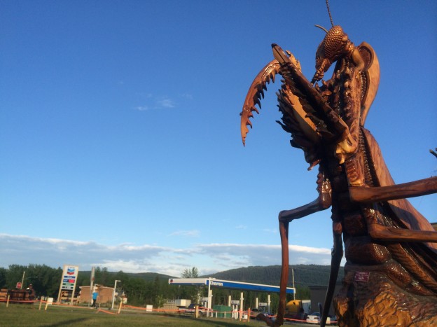
With many delays for road repair (we’re told to get used to it in the North as summer is the only time to repair a year’s worth of winter snow/ice damage) and having a front row seat watching a tow truck try to maneuver a big rig that went over the edge (he gave up and let us through while he got more tow trucks), we finally got to Chetwynd on the first day of the International Chainsaw Carving Contest.

IMG_0247

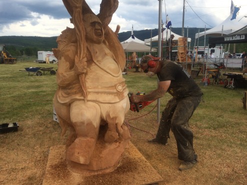
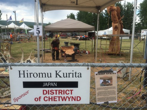
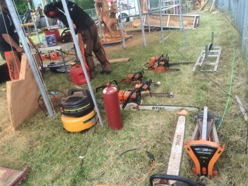
You can hear the competition from all over town as competitors from Japan, Germany, Australia, the US and Canada hack massive wood stumps with 6 different sizes of chainsaws and weed wacker looking machines on long wands. The Japanese competitor has won 3 first places here in years past and is working on something very tall with lots of soaring eagles.

IMG_0246

Observers eat picnics in the viewing stands or don safety glasses and get close…and covered with wood chips and sawdust, like us.

IMG_0241

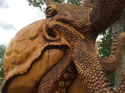
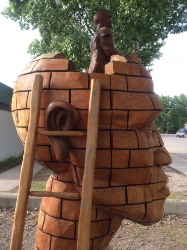
The 13 winners leave their sculptures each year for the town to exhibit in indoor and outdoor public spaces. There are 130 sculptures around town.

IMG_0263

We are fine-tuning our trip North balancing the need to get to the START of the 300 mile gravel road to the Great Northern Arts Festival by July 1st, but not wanting to travel too fast so that we arrive before the ice has broken up, and before the ferry service on the rivers begins. As it just snowed last week in Dawson City, YT arriving immediately is too early. We were in a local restaurant discussing the wisdom of taking a long gravel road as an alternative route north. Two different tables near us overheard our conversation (do you think Steven and I might just be a little LOUD?) and jumped in to tell us how stupid we would be to take that route (truck drivers), especially as it is not that pretty (locals). The truckers drive the ice roads to Tuktoyaktuk on the Arctic Ocean all winter. Apparently there is a TV reality show called, “Ice Truckers” that features guys like him. Without four-wheel drive, we must take the more conservative route and opt for more of the (paved) Alaska Highway. I am sure that it is a lot more pleasurable to watch a tow truck haul someone else’s flipped over rig out of a tricky situation than your own…

IMG_0286


ARE WE THERE YET…?: ENROUTE TO ALASKA/ARCTIC OCEAN

WHERE ARE WE?

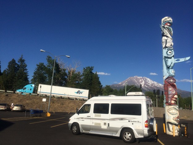
In the tradition of Click and Clack of Car Talk/NPR, we have a puzzle for you. Look at the feature image taken yesterday of our Roadtrek and note the following clues:

1) the blue truck is on Hwy #97, the Alaskan-Canadian Highway, AKA: the “Al-Can”;

2) there are glaciers in the background;

3) the totem pole is a First Nation carving with a copy in Delta Junction, Alaska on the Al-Can; and

3) it is 7:00 PM and the air temperature is 91 degrees Fahrenheit……really.

Answer: We are still in California, on the first day of our trip to Inuvik, NT Canada, the Arctic Ocean, and Alaska.

Weed, CA sits under Mt. Shasta, a glaciated dormant volcano, at the Southern Terminus of the Alaska-Canadian Highway. Thus the totem pole….and the very hot, drought plagued California summer.  The Al-Can will wind its way north along the “Volcano” route  through California, Oregon, Washington within the U.S., and through the Canadian Provinces of British Columbia and the Yukon Territory to its Northern Terminus in Delta Junction, Alaska, 1367 miles above the US/Canada border.

Instead, we’ll meander north using alternate (slower routes) and gravel roads, to allow maximum camping and hiking. We won’t jump on the Al-Can until Dawson Creek, British Columbia when we will follow it to the Yukon Territory. The final 400 miles will be on gravel roads in Canada’s Northwest Territory, arriving in Inuvik for the Great Northern Arts Festival in Mid-July.  There, we will work as volunteers, and enjoy the daily workshops taught by the First Nation Tribes. A short plane ride 45 miles north will bring us to a swim in the Arctic Ocean….and then it’s all driving south from there…through the Yukon, Alaska and British Columbia 3,130 miles back home. Whew! The lengths we will go to to avoid the drought in California this year…..and catch the Northern Lights and the Midnight Sun!